Published On Dec 31, 2019
Global Mapper: Step by Step (Survey Mapping Made Simple) : https://amzn.to/32mzYkx
Introduction to 3D Data: Modeling with ArcGIS 3D Analyst and Google Earth: https://amzn.to/32kPk8R
Learning GIS Using Open Source Software: An Applied Guide for Geo-spatial Analysis: https://amzn.to/32dl7st
Remote Sensing And Gis by oxford: https://amzn.to/3mFhint
Remote Sensing and GIS by OUP India: https://amzn.to/3Fkepje
Learning Arc GIS: Step by Step: https://amzn.to/3mkkVi9
The Esri Guide to GIS Analysis, Volume 1: Geographic Patterns and Relationships (The Esri Guide to GIS Analysis, 1): https://amzn.to/3q8107r
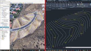
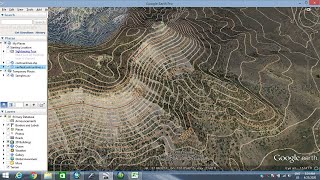
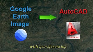
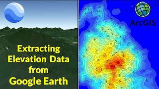
How to get contour data from google earth by giving a boundary or polygon.
How to import GOOGLE EARTH file in GLOBAL MAPPER.
How to export a DWG or DXF file type from GLOBAL MAPPER.
MUSIC: / audiolibrary
FACEBOOK: www.facebook.com/architecartist
YOUTUBE: / sketchupartist
TWITTER: arpiyush21
INSTAGRAM: arpiyushpant