Published On Dec 12, 2017
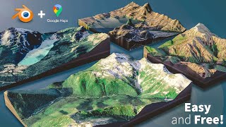
In this video, we're going to discuss creating a sliced terrain model from the location data in SketchUp!
Want to Support the SketchUp Essentials?
/ thesketchupessentials
http://www.thesketchupessentials.com/...
DOWNLOAD SLICER
https://sketchucation.com/plugin/781-...
DOWNLOAD JOINT PUSH PULL
https://sketchucation.com/plugin/715-...
MY YOUTUBE SETUP
https://kit.co/TheSketchUpEssentials/...
(Affiliate Links)
PLEASE LIKE AND SUBSCRIBE
Check Us Out On -
Website - http://www.thesketchupessentials.com
Twitter - / easysketchup
Facebook - / thesketchupessentials
Pinterest - / easysketchup
To create a sliced terrain map from SketchUp location data, we're going to use the extension Joint Push Pull to create a solid from the terrain data, then use the extension slicer to slice the model into different planes.
Disclaimers: all opinions are my own, sponsors are acknowledged. Product Links in the description are typically affiliate links that let you help support the channel at no extra cost.