Published On Dec 7, 2023
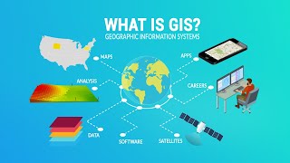
Geoprocessing is a framework and set of tools for processing geographic and related data. The comprehensive suite of geoprocessing tools can be used to perform spatial analysis or manage GIS data in an automated way. A typical geoprocessing tool performs an operation on a dataset such as a feature class, raster, or table, and creates a resulting output dataset. the geoprocessing tools include Merge, Buffer, Dissolve, Clip, intersect, Union,etc.which in this episode we go to ArcGIS software to apply each one of the following geoprocessing tools.
_________________
Buffer: buffer Creates polygons around the input features to a specified distance.
_________
Clip: We Use this tool to cut out a piece of one feature class using one or more of the features in another feature class as a cookie cutter
_________
Intersect: Intersect Computes a geometric intersection of the input features. Features or portions of features which overlap in all layers and or feature classes will be written to the output feature class.
_________
Union: Union calculates the geometric union of any number of feature classes and feature layers. All input feature classes or feature layers must be polygons
_________
Merge: Merge command Combines multiple input datasets into a single, new output dataset. This tool can combine point, line, or polygon feature classes or tables.
_________
Dissolve: Dissolve command Aggregates features based on specified attributes.
_________________
in this video we've shown you how to apply the geoprocessing tools to your data in ArcGIS, you can apply other Geoprocessing Tools in the same way using ArcGIS, Hope you find it useful.
________________________
🔴 Check it out:
- Like & Share the video with others:
✅ • ArcGIS Geoprocessing tools (Buffer, C...
_ _ _ _ _ _ _ _ _ _ _ _ _ _ _ _ _ _ _ _ _ _
- Subscribe to our channel :
✅ / @rsgis6997
=========================================================
#GIS #ArcGIS #ArcMap #Geoprocessing