Published On Aug 13, 2019
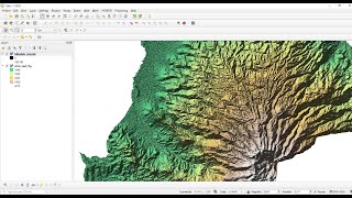
Create topographic contours from a digital elevation model (DEM). This QGIS tutorial will cover how to create contours and customize the appearance of contour lines and labels. One common way to display contour maps is creating and labeling only index contours. This process may seem a little complicated, but can actually be done quite quickly. This video tutorial will show you how!
Step-by-step instructions for newer QGIS versions: https://opensourceoptions.com/blog/ho...
show more