Published On Aug 30, 2023
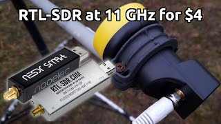
In addition to the VHF signals I've looked at before, many weather satellites also use something called HRPT (High Resolution Picture Transmission) on a microwave frequency. This is a little more challenging to detect, and requires tracking low orbit satellites as they pass by.
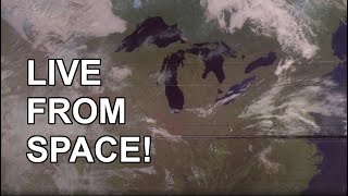
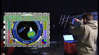
After a LOT of struggling and failures, I was finally able to record and decode some of these higher-res satellite images. Ironically, the antenna feed that worked best was something made from coathangers and putty!
I may try to follow up on this in a future video, since there are many more satellites that use this system, not just NOAA 19 which I used here.
Some possibly-helpful links:
Satellite pass calculator: https://www.n2yo.com/
Nano VNA V2: https://www.ebay.com/itm/353177205291
Calibrating and using the VNA: • NanoVNA V2 Calibration and Antenna Me...
Mini QFH Antenna kit (kinda sucks): https://www.ebay.com/itm/384774467100
Mini QFH antenna info: https://www.dd1us.de/Downloads/QFH-An...
QFH Antenna calculator: https://www.jcoppens.com/ant/qfh/calc...
Ground Plane antenna design (worked better!): https://m0ukd.com/calculators/quarter...
Satdump software: https://github.com/SatDump/SatDump
SDR++ Software: https://www.sdrpp.org/
Possible source for folding satellite dish: https://sub-lunar.com/products
The following affiliate links give me a commission if you buy from them!
RTL-SDR Blog V3 Software Defined Radio: https://www.amazon.com/dp/B0BMKB3L47?...
SAWbird+GOES LNA: https://www.amazon.com/dp/B07K1M39H4?...
Saveitforparts t-shirts and other merch at https://saveitforparts.myspreadshop.com/
Join this channel to get access to perks:
/ @saveitforparts
Or support me via Patreon at / saveitforparts