Published On Feb 14, 2022
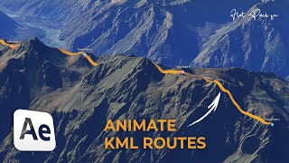
This tutorial is part 13 of the OSINT At Home series. The tutorial is an explainer of how to use mountain ranges and ridge-lines to geolocate a photo or video, specifically using the 3D mountains visible in Google Earth to identify the location of photos and videos.
Geolocation is an important stage in verification, research and investigations. Whether you’re trying to discern fact from fiction by identifying whether a video or photo was really taken where someone says it was, or you’re trying to identify where footage might have been filmed or taken for situational awareness in research and investigations, then if there’s mountains in the background, you might be in luck.
By using 3D features on Google Earth, as well as other open source investigations tools, you can use those mountains to your verification benefit.
The tutorial specifically covers using tools such Google Earth and its 3D function for mountains in geolocation, as well as PeakVisor for geolocation, which shows mountains in more detail than what is sometimes seen on Google Earth. If you are trying to get better at geolocation and verification, or just looking to increase your visual OSINT and IMINT skills, then this video might suit you.
The OSINT At Home series is useful for those looking to find digital breadcrumbs and pick up some methods of open source intelligence (OSINT), digital investigations and good old plain research. No matter who you are, or where you are in the world, you can follow these tutorials from home with publicly available information to answer questions such as who, what, where and when.
TOOLS
Google Earth Pro (desktop): https://www.google.com/earth/download...
PeakVisor: https://peakvisor.com/
MORE RESOURCES
Bellingcat: https://www.bellingcat.com/resources/...
Bellingcat: https://www.bellingcat.com/resources/...
Bellingcat: https://www.bellingcat.com/resources/...
Amnesty International: https://citizenevidence.org/2021/04/0...
Benjamin Strick https://benjaminstrick.com/geolocatio...
CREDITS FOR THIS TUTORIAL
Footage used for tutorial purposes:
Kassala: https://twitter.com/BenDoBrown/status...
Ethiopia: https://twitter.com/MapEthiopia/statu...
Music Intro: World’s Fair – God Mode
Music Title and End: Dhaka by Kevin MacLeod is licensed under a Creative Commons Attribution 4.0 license. https://creativecommons.org/licenses/...
Source: http://incompetech.com/music/royalty-...
Artist: http://incompetech.com/