Published On Sep 12, 2021
★★Skills taught in this video★★
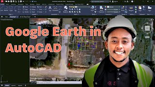
❖How to import latitude longitude and northing easting into a single file in civil 3d
❖how to convert northing easting coordinates to longitude latitude
❖latitude and longitude
❖utm to latitude longitude
【Timecode】
◆0:00➜ Intro
◆0:40-➜point creation tool in civil 3d
◆0:55-➜ Import single point data in northing easting in civil 3d
◆1:55-➜how to change point style in autocad 3d
◆2:30-➜how to set coordinate system in civil 3d
◆3:00-➜Import single point data in latitude and longitude in civil 3d
➤ ►How to add country kit in autocad civil3d 2019 version | how to add india data in civil 3d 2019---- • How to add country kit in Autocad civ...
➤ ►How to change Label style Northing & Easting in Civil 3d | Point Label Style - Northing and Easting--- • How to change Label style Northing &...
➤ ►civil 3d - create alignment from polyline | Creating Alignment from Corridor | offset alignments--- • civil 3d - create alignment from poly...
➤ ►How do you align input and label | Horizontal and vertical alignment road design | civil3d tutorial---- • How do you align input and label | Ho...
➤ ►How to Calculate Earthwork Volumes in Civil 3D | Quantity computation (earth work ) on civil 3d--- • How to Calculate Earthwork Volumes in...
➤ ►Creating Cross Sections | Creating Cross Section Views | Civil 3D cross sections along alignment---- • Creating Cross Sections | Creating Cr...
➤ ►Creating an Assembly in Civil 3D 2020 | How to Create Assembly in Civil 3D | AutoCAD Civil 3D---- • Creating an Assembly in Civil 3D 2020...
➤ ►How to generate/create design (horizontal & vertical alignment) report in civil 3d- • Horizontal and Vertical Alignment Rep...
➤ ►how to import/add points/survey data in Autocad civil 3d- • How to import/add points/survey data ...
➤ ►How to extract data or latitude and longitude from autodesk autocad civil 3d drawing- • How to extract data or latitude and l...
➤ ►how to extract data from Google earth Pro using Global mapper- • how to extract data from Google earth...
➤ ►how to imports point/survey data creating contours with surface in civil 3d - • How to imports point/survey data crea...
➤ ►how to create horizontal alignment in civil 3d- • how to create horizontal alignment in...
➤ ►How to add country kit in autocad civil3d 2020- • How to add country kit in autocad civ...
➤ ►Extract point data from a surface in civil 3d | Extracting Points from a Surface | Surface Data--- • Extract point data from a surface in ...
➤ ►Vertical profile in civil 3d | design profile in civil 3d | How do you create a vertical alignment- • Vertical profile in civil 3d | design...
➤ ►Add vertical curve label to profile Civil 3D | how to add curve details in vertical alignment-- • Add vertical curve label to profile C...
➤ ►Creating a corridor in civil 3d | Creating Sample Lines in Civil 3D 2020 | Civil 3D sample lines-- • Creating a corridor in civil 3d | Cr...
latitude and longitude
latitude and longitude in civil 3d, civil 3d latitude longitude, how to get latitude and longitude in civil 3d, how to label latitude and longitude in civil 3d, how to find latitude and longitude in civil 3d
➥TELEGRAM ➠https://t.me/Ytcivilsoft
➥ INSTAGRAM➠https://www.instagram.com/invites/con...
➥ Facebook➠https://www.facebook.com/groups/20881...
➥WhatsApp➠https://chat.whatsapp.com/JNK3FcppFMY...