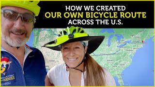
Published On May 2, 2023
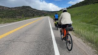
In this video I describe my process and the many resources I have used in pulling this 4000+ mile trip of ether.
— Public Radio Atlas: https://publicradioatlas.org/
— National Park Maps: https://www.nps.gov/subjects/gisandma...
— Yellowstone: https://www.nps.gov/yell/index.htm
— Bury My Heart at Wounded Knee, the Book: https://amzn.to/422Fcvv
— Wounded Knee, the Massacre and Site: https://www.history.com/topics/native...
— Illinois Bike Trail Map: https://rideillinois.org/maps/state-a...
— Ohio-to-Erie Bike Trail: https://www.ohiotoerietrail.org/
— East Coast Greenway: https://www.greenway.org/
— Allegheny Gap Trail (Great Allegheny Passage): https://gaptrail.org/
— C&O Canal Towpath: https://www.canaltrust.org/plan/co-ca...
— Warm Showers: https://www.warmshowers.org/
— Adventure Cycling: https://www.adventurecycling.org/
— Rails-to-Trails: https://www.railstotrails.org/
— Ride with GPS: https://ridewithgps.com/
— Komoot: https://www.komoot.com/
— Google:
— Maps: https://maps.google.com/
— Street View: https://www.google.com/streetview/
— Earth VR: https://vr.google.com/earth/