Published On Sep 4, 2019
Manikgad fort is located between khopoli and panvel near Vashivali. The height of the fort is about 1900 feet. The fort was used to track the trade route from the west coast to Maval.
There are 2 ways to reach Manikgad from Vashivali.
One route goes through the Wadgaon village near Vashivali. It takes around 3.5 to 4 hours to reach the fort from here.
The second route passes through Thakarwadi. By 2 wheeler, one can reach Thakarwadi which is 3 km from Vashivali. The bike can be taken ahead till Katakarwadi which is 1 km away from Thakarwadi. We reached the fort by the same route. It took us half an hour to reach Katakarwadi as the road here is in bad condition. It took us 3 hours to reach the fort from Katakarawadi. The Wadgaon route too goes from Katakarwadi and it takes 45 mins to reach katakarwadi.
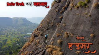
From the Katakarwadi, rock mountain of the fort can be seen. One has to go from the back side to reach the fort. From here you have to walk straight up the big plateau till the base of the fort. The residents of Thakarwadi said that bikes can be brought to this plateau after the monsoon.
Next, take the right turn keeping fort hill on left side. From here route goes through the forest. During the monsoon, water streams can be seen at some places.
After walking for some time, we arrive at the Maruti temple. From Katakarwadi till maruti temple, the road is not steep.
Leave this temple behind and walk further for 10 minutes and turn left. From here the steep climb of the fort begins. This route is on the opposite side of the fort hill visible from the Katakarwadi.
Next, the route goes up through the main hill of Manikgad and the hill besides it.
After climbing for about an hour, we reach the flat portion. Here the remains of the first gate of the fort can be seen. From here, fortification of the fort is visible. There is a water tank nearby. The route from here takes you to the top of the fort in 15 minutes.
After reaching the fort, one can see the limestone crusher. Going forward, a door frame appears. Ganesha is engraved on this. A small stone made temple exists in front of the darwaja. As we walked through the door structure, one of the largest water cisterns appeared. There is also a small tank next to the large cistern. The water is not drinkable. Some broken ruins can be seen here. Continuing on straight, there is a short walk to the north bastion. One can view the entire area from here like Wadgaon, Thakarwadi, Plateau etc.
From Manikagad, one can see Irshalgad, Prabalgad, Kalawantin Durg, Matheran Plateau, Karnala.
The path which goes down from the east side bastion of the fort leads to some water tanks and a small temple of Mahadeva. The water in small tank is potable.
Keeping east side bastion on left, We went down and reached the place where we started.
There are two ways to reach Vashivali via Mumbai Panvel.
1. Panvel - Rasayani - Vashiwali : 19 km
2. Panvel - Old Mumbai Pune Highway - Chowk - Vashivali : 27 km.
The distance from Mumbai to Vashiwali is 54 km.
From Pune, Vashivali is 92 km via Khopoli chowk. (Old Mumbai pune highway)
In 1665, the forts given to the Mughals in Treaty of Purandar were mostly from the northern Konkan and Maval areas. Manikgad was one of them.
The trek is lengthy. As the vegetation grow in the rainy season, it is advisable to take a guide along with you for safer side. The fort top is not too large so one can see the fort in half hour. It took us 2 hours to reach Katkarwadi back.
Vashiwali to Thakurwadi: 1.5 km
Thakurwadi to Katkar Wadi 5.2 km
Pune Chowk Vashiwali 90 kms
Vashivali 5 Kms via Mumbai Panvel Rasayani.
Panvel Rasayani Vashivali 90 kms
Panvel Chowk Vashiwali 5 Kms
रायगड जिल्ह्यातील गड किल्ले • रायगड जिल्ह्यातील गड किल्ले
श्री शिवाजी देशमुख (local Guide)
+91 8554-086111 / +91 86987 26111
#manikgad #treksnearmumbai #manikgadfort