Published On Oct 13, 2024
Go find the route and details here: http://greatchalkway.org.uk/
and: http://icknieldwaypath.co.uk
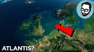
Welcome to this weeks video which takes a look at how Doggerland and how the shrinking ice during the Mesolithic may have influence the Ridgeway and its formation. We also take a look at the Great Chalk Way. A new route lauched in October 2024, combining some pre existing national trails and pathways. The route is 400 miles long and takes you from The Wash all the way to Lyme Regis.
To be very clear, the views represented in this video by me, are indeed my own little theory and do not nessecarily those represented by others in the video. I mean.... they might be, but I didn't ask
Join this channel to get access to perks:
/ @pwhitewick OR
Patreon: / paulandrebeccawhitewick
Videos To Watch Next:
• Is the RIDGEWAY really 5000 years old? - How old is the Ridgeway?
• How we Misunderstood AVEBURY - Understanding Avebury
• THE Roman Milestone PROBLEM - How to find a Roman Milestone
• The 5 pence Toll Bridge - That doesn'... - The 5p toll bridge!
Usual notices:
1. We are not historians. We enjoy researching and learning, and with that we enjoy sharing our journeys with you. That said, sources for information often listed below with credits.
2. Corrections. Whilst we make every attempt to not include any errors, research, and piecing stories together from dozens of sources sometimes leads to one or two. I will note here if any are found:
Errors
1. My graphics always need improvement, so the examples shown of the maps from doggerland are essentially me drawing them, and not intended to be wholey accurate.
Credit and thanks for assets
Huge thanks to Mary Tebje for inviting us along: https://marytebje.com/
Guest speaker: Mary-Ann Ochota: https://www.maryannochota.com/
Long UK Maps: https://mapswire.com/maps/united-king...
Filter: Snowman Digital and Beachfront
B-Roll Maps: Google Maps and Google Earth Studio
Maps: National Library of Scotland Maps:
OS Maps. Media License.
Stock Footage: Storyblocks
Music: Storyblocks, epidemicsound and artlist
Old Map: NLS - https://www.nls.uk/
Credit for images/footage:
Doggerland 1: Francis Lime
Doggerland 2: Vincent Gaffney
Graphs and images undersea: Vincent Gaffney
Barbed antler spear: Norwich castle musuem
Iron Age drawing: Bill Nicholls
Chapters:
00:00 - The Problem
01:38 - The Ridgeway
02:56 - The Great Chalk Way
04:36 - The Evidence
07:00 - The Theory
10:28 - Avebury and Sanctuary
Sources:
https://www.swindonadvertiser.co.uk/n...
https://archaeologynationaltrustsw.wo...
https://www.megalithic.co.uk/article....
http://www.unofficialbritain.com/lost...
https://researchframeworks.org/mariti...
https://www.cambridge.org/core/journa...
https://en.wikisource.org/wiki/Submer...
#GreatChalkWay #ridgeway