Published On Apr 10, 2020
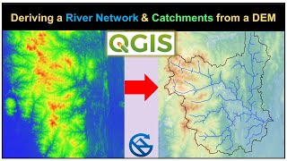
This video shows how to automate the stream and catchment delineation procedure in QGIS using the Graphical Modeler.
This video is part of IHE Delft OpenCourseWare. More free materials are available at http://www.gisopencourseware.org
(c) OpenStreetMap Contributors
---------------------------------------------------------------------------------------------------------
Note that with the new dependencies in QGIS this will not work.
For work around see: • Install QGIS with SAGA 2.x (old depen...
And also see: https://github.com/qgis/QGIS/issues/4...
---------------------------------------------------------------------------------------------------------
show more