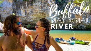
Published On Jul 4, 2022
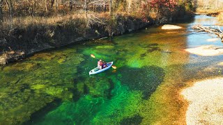
Our first adventure down The Lower Mountain Fork River. While we planned for a 3-day, 2-night trip the river was FLOWING and we knocked it out in a little over 24 hours. This trip consisted of the most aggressive rapids we have seen thus far which was fun but the camping was limited. We traveled miles before finding a spot to camp because most of the land was private property and you have to be careful camping on the shoals because of the raising water levels.
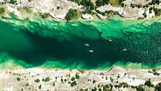
The Lower Mountain Fork River is a short, but very exciting, whitewater/flatwater run that is probably the most consistently flowing and best whitewater stream in Oklahoma, a state not particularly noted for whitewater rivers. Its location in southeastern Oklahoma makes it accessible to paddlers from North Texas, Louisiana and Arkansas, as well as Oklahoma.
Starting below Reregulation Dam, the river is more technical than "big", with several respectable Class I-II rapids within the first two miles of the put-in. The downside to this trip is that most the rapids are in that first two miles. The upside is that you can get your boat back to the top and run it again - several times in a day, if so desired. Or, you can run on down the flatwater stretch to the take-out at Ashalintubbi below the confluence of the Little River. From Re-regulation Dam at Mountain Fork Park the river flows about 12.5 miles to the Little River confluence along the northern boundary of Ouachita National Forest. While several outfitters have private access points below the US Highway 70 bridge the next public access point is Ashalintubbi on the Little River at about 16.6 miles, then the Arkansas State Highway 41 bridge near Horatio at about 27.8 miles, then the US 59/79 bridge below the Cossatot River confluence at about 58.9 miles.
Paddlers will find occasional small riffles along the river, and summers will bring out significant numbers of paddlers as well as fishermen looking for trout, walleye and other species of fish. Mountain Fork Park, located immediately below Reregulation Dam on river right, is a great campsite with reasonable fees that range from $8-$15 per site per night, depending upon features and amenities. Water and electricity are available in some campsites. Both public and private access points are available between Reregulaton dam and Ashalintubbi though public access is limited to the US Highway 70 bridge between Broken Bow and Eagletown, and the Arkansas SH 47 bridge south of Horatio.
Many trees line the natural and undeveloped banks of the river along its entire reach, and bald cypress trees will be found growing on rock islands in the middle of the river, as well as along the banks. Just below the US Highway 70 bridge a railroad trestle bridge crosses the river and represents about the last sign of civilization paddlers will see going downriver until a few riverside houses start making their appearances above and below the Little River confluence. Visitors will enjoy canoeing, kayaking, tubing, camping, swimming and fishing this Ouachita National Forest stream which flows very near the Arkansas State Line. The Lower Mountain Fork is a very scenic river with verdant banks from spring through late fall.
CREDIT: http://southwestpaddler.com/docs/litt...